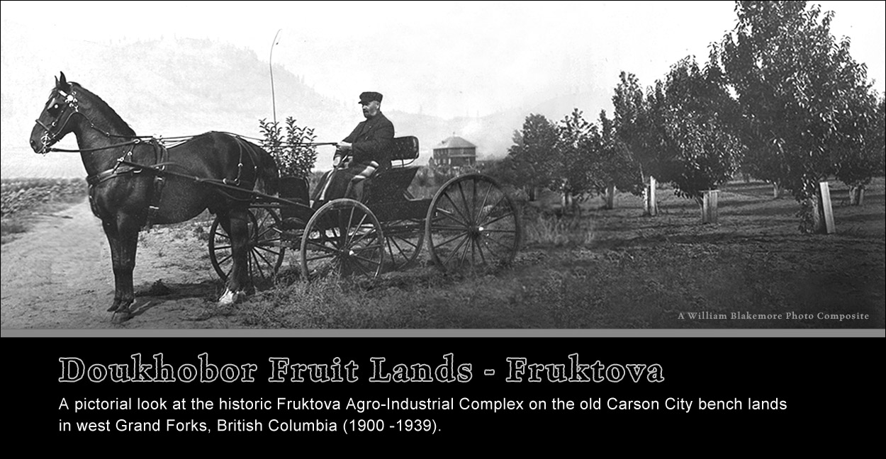
Waterloo forest and Carson fruit land ...
The first private land purchases by the prairie Doukhobors in British Columbia
Displaced in 1907 from their homestead colonies on the Canadian prairies where they had settled in 1899, (Link) the community-minded pacifist Doukhobors entrusted their leader, Peter V. Verigin, to seek and purchase suitable large tracts of private land for resettlement in British Columbia, where a pledge of allegiance to an earthly crown would not be required. The climate of the Pacific province was furthermore understood to be much more favourable for this group of Doukhobors as vegetarians, where they might cultivate vegetable gardens and fruit orchards. Two community delegates, Simeon Reibin and Nicholas Zebroff, were chosen to accompany Peter Vasilievich to fulfill this task for the benefit of the community. They completed the purchase of 2700 acres at Waterloo (Castlegar) on April 14, 1908, (Link) the very first of numerous other such acquisitions to follow in the West Kootenay-Boundary region.
This first purchase was not without controversy however, and not as simply reported in local newspapers. And the actual arrangements, to this day, have yet to be determined. But even then in 1908, according to a later account of this purchase by delegate Simeon Reibin, he had questioned the integrity of real-estate agent Adolf Maurer, and likewise indeed, the personal judgement of Peter Verigin, for purchasing a "primeval forest" rather than a fruit land. (Link) And he either abandoned the group in frustration, or was just quietly replaced by another delegate.
A subsequent search by Peter Verigin for land in the Okanagan and Similkameen in the following winter of 1909, according to the Keremeos Tribune (Feb. 20, 1909), was not successful, and he then returned to Grand Forks, in the Boundary country along with Zebroff and another young associate, John Sherbinin, where they were led to believe that there were pre-existing young orchards in the Carson district for sale.
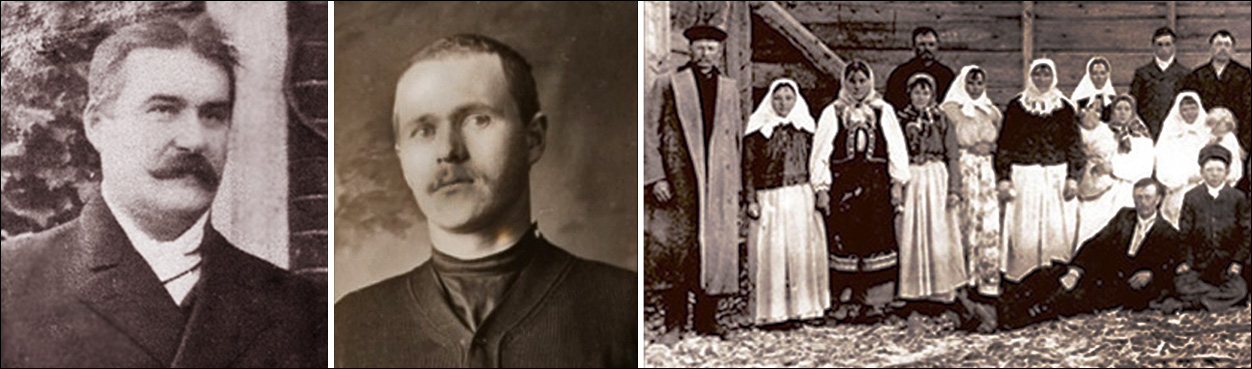
Peter V. Verigin is depicted at left, young John Sherbinin to his right. J. Sherbinin was Mr. Verigin's interpreter and a community business manager and purchasing agent at Ootischenia/Brilliant in the West Kootenays. With an apparent natural aptitude for business, he acquired his fluency in the English language, and his expertise in wholesale and retail commerce while working as a sixteen year-old in a prairie Swan River, MacKay & Stevens, general store. Zebroff, depicted at right with a group of villagers, was on the other hand self-admittedly illiterate, yet also quite capable in trade and commerce, learning from similar experiences in Saskatchewan. He would later temporarily act as a business manager for the Fruktova community in Grand Forks.
The Grand Forks Carson benchlands
On their arrival in Grand Forks and Carson in 1909, the delegates curiously may have witnessed the very scene used in a Winnipeg newspaper ad promoting Kootenay Valley orchards, by the same agent Maurer, that had sold them the Waterloo "primeval forest". (Link) Clearly misrepresenting Kootenay "fruitlands", it is unknown whether he had shared the ad with the prairie Doukhobors.

This photograph depicts the Carson benchland orchards that had pre-existed the arrival of the Doukhobors. One of the first few on record depicting these orchards, it was likely taken in 1905 by surveyor John S. Dennis, son of the Canadian Surveyor General, involved in the prairie Dominion Land Survey. It appeared in a book he authored for the CPR Lands Department promoting the Okanagan-Boundary and Kootenay country. This agricultural region near the American border about two miles west of Grand Forks city, was named after the Carson family and an old townsite of that name, a short distance away below the bench. The house depicted in the middle ground belonged to the Vaughan family, situated approximately where the Strukoff (Kulyukovka) Doukhobor village would be later located. This was their second house on this site, newly rebuilt along, with a new horse barn, after the first one was destroyed by fire in 1903.
This photo of the neigbouring Covert orchard was taken a few years earlier. It appears in a 1900 photo album featuring dozens of remarkable William H. Carre photographs of prominent places of interest in British Columbia. The fruit trees are visibly less mature in this view, although, according to an article in the Grand Forks Gazette, in 1903, this was praised as the largest orchard in British Columbia. Unable to maintain their orchard in their later years, and in poor health, the Coverts reluctantly subdivided their large Crown Grant District Lot 497 in 1905, placing about half of it for sale in 10 acre plots, supplying each with a pressurized water system drawing water from July Creek at Spencer Hill.The same W.H. Carre photo album also included a stunning "Bird's Eye View of Grand Forks" in 1900.

Grand Forks newspapers reported in 1909 that Mr. Verigin and his associates had negotiated a deal with the McCallum & McArdle agency, to purchase 900 acres of John Coryell's land (DL 453) for $39,000 in cash, and 160 additional acres of his brother's adjacent lot for "running irrigation ditches". (Link) Aside from the Coryell lots, they also reportedly purchased the Vaughan/McInnis lands (DL. 364 and DL. 365) in March 1910, and five 10 acre parcels, Blocks 10, 13, 14,15 and 16, from the Covert Estate (DL. 497) in 1912.
And with additional adjacent purchases, by 1912 the Doukhobor Community would ironically own most of the Carson benchland depicted in Maurer's promotional advertisement. And this Carson settlement, in Doukhobor hands, would become known as Fruktova or Fruktovoye.
The following map of the Grand Forks Doukhobor village settlements illustrates their geographical extent as they were settled between 1909 and 1938. It also illustrates the three main CCUB (Christian Community of Universal Brotherhood) admistrative regions within West Grand Forks.

The Upper Carson Fruktova Benchland
In 1912, a BC government inquiry, the Blakemore Royal Commission on Doukhobors, (Link Report), (Link to Web page) was called to investigate the concerns of certain pre-existing non-Doukhobor local settlers regarding the adverse impact of these extraordinary land purchases on the general community. Numerous witnesses were called by the Commissioner to consider their grievances, and on others to testify about the more positive ways in which the Doukhobors may have been expected to contribute to the local economy.
The transcripts of the Grand Forks proceedings (Link) reveal interesting details about the acquisition of these acreages, the state and type of cultivation, the produce grown, and the means of marketing it. It is interesting to note that, despite the focus on fruit lands, there had been considerable interest by the earliest Doukhobors in the marketing of berries and vegetables. Zebroff's testimony lists among them, the cultivation of raspberries, strawberries, currants and gooseberries, and as vegetables, cabbages, tomatoes, and watermelons. Sackfulls of potatoes were also said to be routinely sold at Phoenix, and many carloads were shipped to their own West Kootenay settlements and the public at large.

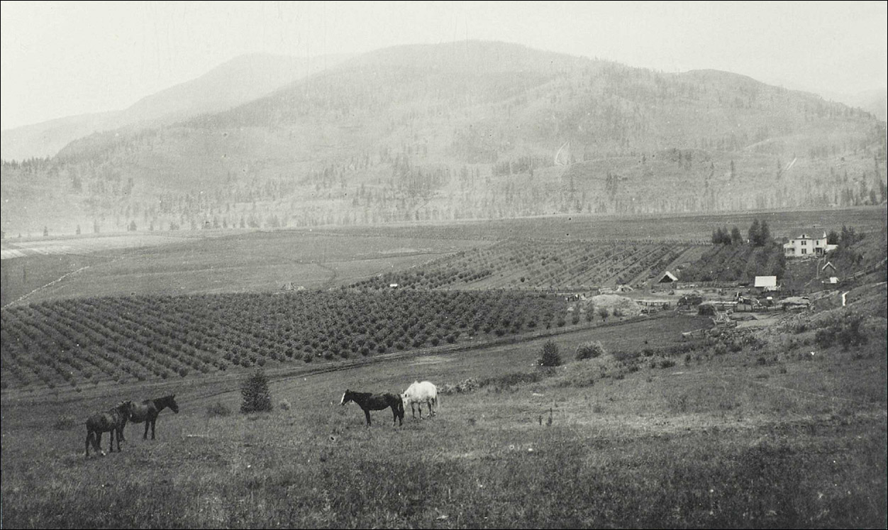
A personal interpretation of this historic photo would suggest that it depicts a western view of the Carson Fruktova benchland with a focus on what is now Canning Road. South of the dirt road (at left) was likely the previous orchard of Vaughan & McInnis with the Doukhobor Sirotskoye Village in the far distance. The former Coryell-Murray Crown Grant Lot 453 is likely at right, and the Doukhobor Fruktova Brick Works, a faint cluster of buildings, is visible in the middle distance at right. A vintage survey map, examined later below, indeed identifies this to be the former site of the old Coryell family log cabin and small brick yard.
This ranch was Peter Verigin's first purchase in Grand Forks, and the maturity of the Doukhobor orchards here would suggest that the photograph may have been taken in about 1912, during or after William Blakemore's visit. Neil McCallum (of McCallum and McArdle) was called by Blakemore to represent the local real-estate perspective, and his testimony referenced the sale of these Vaughan-McInnis and Coryell properties. (Link)
The Doukhobors continued cultivating pre-existing fruit orchards, and purchased additional seedlings to supplement their continued growth, while at the same time, the Fruktova settlements themselves soon blossomed as a vibrant, unified community, and a social and cultural society. Over twenty unique new residential villages were constructed, their multi-family brick faced "doms" in time becoming iconic symbols of the community's prosperity. Its economic growth was sustained by an impressive self-sufficient Fruktova agro-industrial complex, which provided employment for Doukhobor workers, and much needed community income, from the profits of vegetable and fruit production and the commercial marketing of various other non-agricultural products. The CCUB enterprise included a fruit-packing plant/jam factory, machine/blacksmith shop, brick-making plant, and sawmill, depicted in a number of historic photographs below.
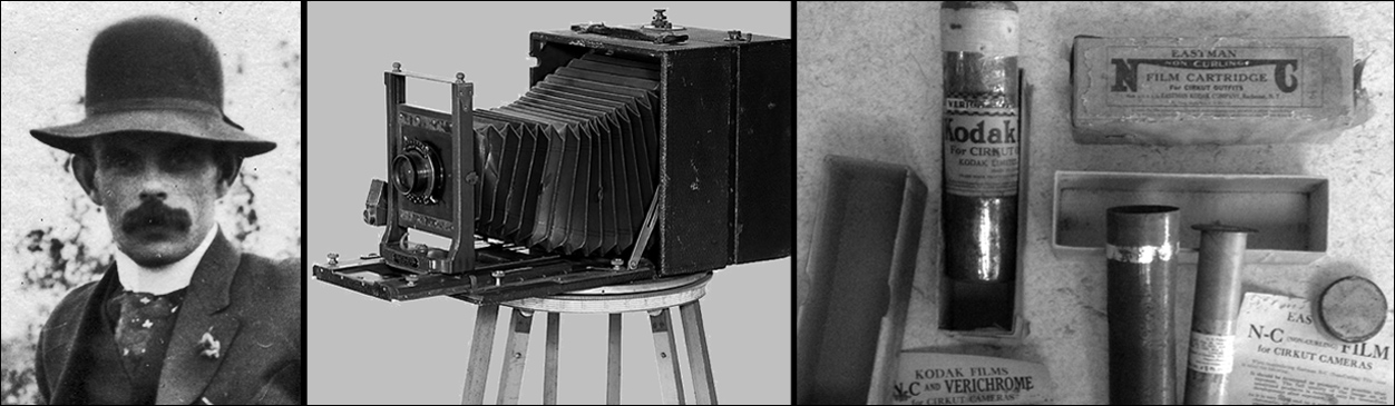
George Albert Meeres, a Nelson photographer, visited Grand Forks in the mid to later 1920s and created four stunning panoramic photographs of the CCUB Doukhobor Fruktova and Khristovoye/Outlook communities which were then near their peak of prosperity. Not quick snapshots, these were thoughtfully composed images methodically taken with a tripod, and likely a sophisticated Eastman Kodak Cirkut camera or other such flexible-film panoramic instrument. Originally a professional photographer in Manitoba, G. A. Meeres moved to Nelson in 1924, where he operated a studio, and being also a classically trained watercolourist, he purchased the Campbell Art Gallery/Studio. With an aesthetic eye and a keen interest in his surroundings, he was truly a photo documentarian, producing an ambitious portfolio of work preserving a visual record of both Nelson and Vernon where he moved in the 1930s. There is no evidence to determine what his objectives were in Grand Forks, but modern Doukhobor historians will be forever indebted to him for also having taken an interest in these communities. His photos posted on this web page are digital copies from the Doukhobor Discovery Centre collection, shared for discretionary use by the Kootenay Doukhobor Historical Society and museum staff.
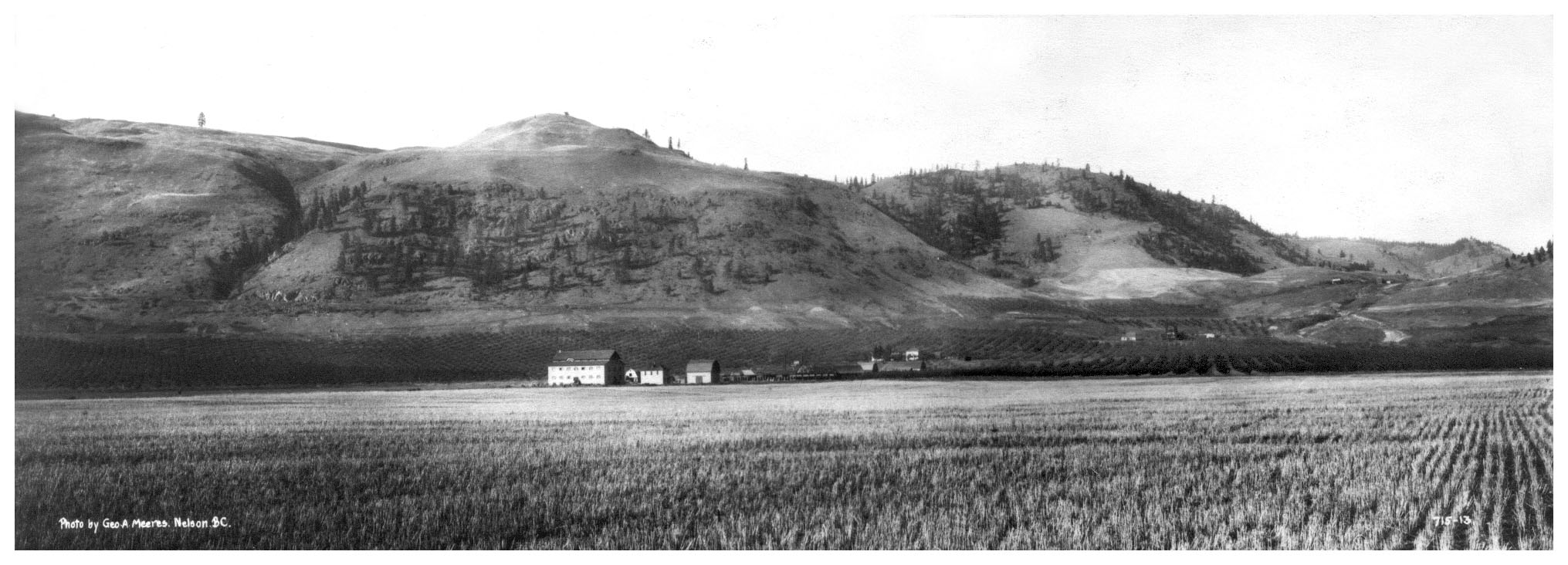
This George Meeres photograph was thought to be taken in approximately 1924-1925. It is a wide-view panoramic depicting the CCUB Fruktova Agro-Industrial Complex including the short-lived jam factory situated on the former Coryell ranch lands. A closer look at this image, (click to enlarge) interestingly reveals what appears to be remaining evidence of the recent 1923 reservoir flood, that scarred the hillside above the railroad, then coursed its way downward over the rail bed and ravaged the landscape and fruit trees below. (Link)

This photograph is a closer view of the northern portion of the industrial complex seen only in the far distance of the previous photo. A Doukhobor sawmill is depicted at left, and a blacksmith or machine shop is at far right, this building later temporarily functioning as a community hall. The Gritchin village brick "doms", obscured somewhat by poplars, appear behind, on a flat narrow bench. The Fruktova school will be built here on this bench in 1929. Immediately behind the photographer was a clay pit and a brick manufactory, and yet further back, the CCUB fruit-packing house (later jam factory) and granary.
"Седлина" (Sedlina), the Russian word for "Saddle"
A shortcut through the shallow pass in the northern hillside above the Gritchin Village, connected Fruktova with the Hardy or Outlook neighbouring community of Khristovoye on the other side. Traversed on dirt road by horse and buggy, the shallow valley indeed resembled the smooth curve of a horse's back where one might place an equestrian saddle, or as in this instance, one may find a small pond or lake. The region at large, including the lake, was thus named "Седлина", the Russian word for "Saddle", transliterated as "Sedlina". Being somewhat swampy at its summit, the pass was not however suitable for expansive orchard cultivation, although the pond or small lake would soon become a source of Fruktova irrigation water.

Another extraordinary panoramic photograph of the Gritchin village and Fruktova School was taken in 1929 by the Trail Hughes Bros. celebrating the arrival of Peter P. Verigin (Chistiakov) to Grand Forks. He is seen crouching on the hillside at right, among a crowd of admiring local Doukhobors. The panoramic camera negatives for this and other such Hughes Bros. panoramas are priceless artifacts now preserved in the Castlegar Doukhobor Discovery Centre archives. - Val McNeil photos.
The BC Archives photo below is a general view from the old Coryell district lots below Saddle Lake, looking southwest at the former Vaughan and Covert orchards. A lower photo depicts apple-pickers in a Community orchard on former Coryell lands.
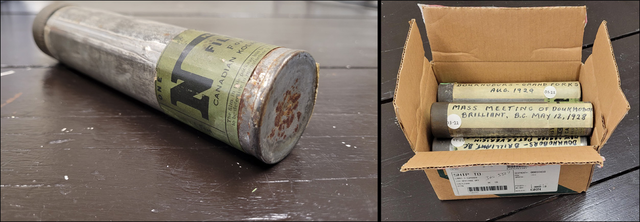
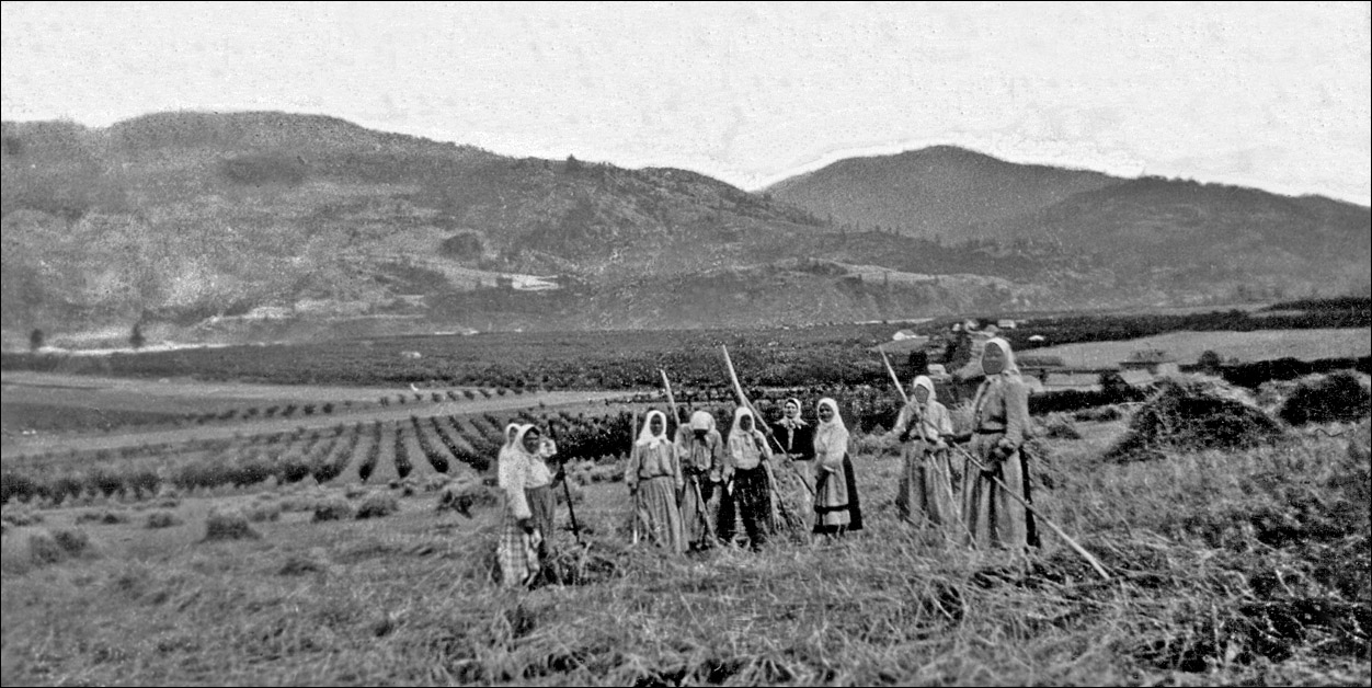
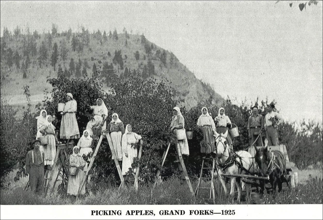
The CCUB Doukhobor Fruktova Brick Works
Nelson News pressman and local historian, William (Bill) Rozinkin began his highly detailed and interesting account of the history and workings of the Fruktova Brick factory with a brief but intriguing revelation about the Coryell ranch.
"On this ranch was a horse-powered clay mixer, a small hand-operated brick molding machine and a promising clay pit. Located three miles west of Grand Forks, the small operation was put to immediate use (by the Doukhobors) and soon reached its capacity as demands grew for quality brick.
The following year production was increased with the installation of new steam-powered machinery and equipment that manufactured bricks until 1932, supplying both employment and materials."
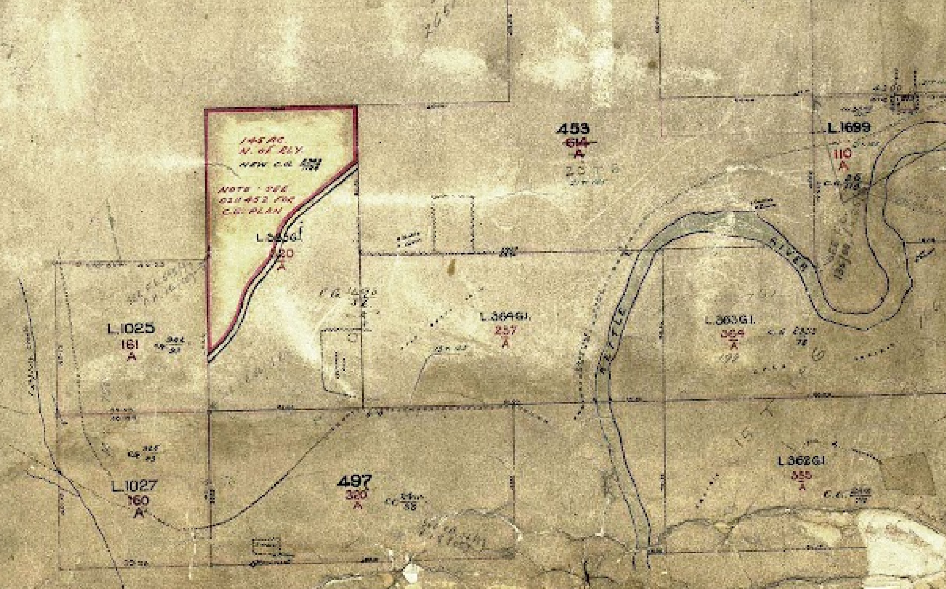
A survey of Townships and Crown Grant lot boundaries in the Kettle Valley was done by two Vernon surveyors, J.P Burnyeat and John A. Coryell, who were business partners in the 1890s. John Coryell was subsequently a land holder of District Lot 453 here in question, a corner of which is depicted in this graphic. The surveys routinely marked dirt roads and other evidence of human occupation. Newpapers reported that the Coryell's had contracted a fence to be built around their ranch, and the fence would surely not have enclosed the full acreage, so we can presume that the ragged rectangle on the survey may have defined the perimeter of the reported ranch. The lettering on close examination appears to read ... "stable" and "cabin". The old survey map was aligned with a current B.C. Parcel Map to visualise DL. 453 boundaries, and the correlation places the survey rectangle in close proximity to the Fruktova Clay pit. This would have also likely been the location of the Coryell horse-powered brick making machine, in modern terms, on the current Canning Road.
The historic Castlegar horse-driven Brick Works
While there appears to be a revival of interest in brickyards, the horse-drawn-variety has not been particularly newsworthy. Castlegar writer/historian and Credit Union executive, Harold Webber, was however well aware of such a Brick Works in Castlegar, first publishing its story in his booklet "People and Places" in 1975, and then later in the old Castlegar News. His story addresses the workings of these brick machines, offering insight into what the Coryell horse-driven machine may have been like. Although be warned, his story has a tragic twist. (Link)
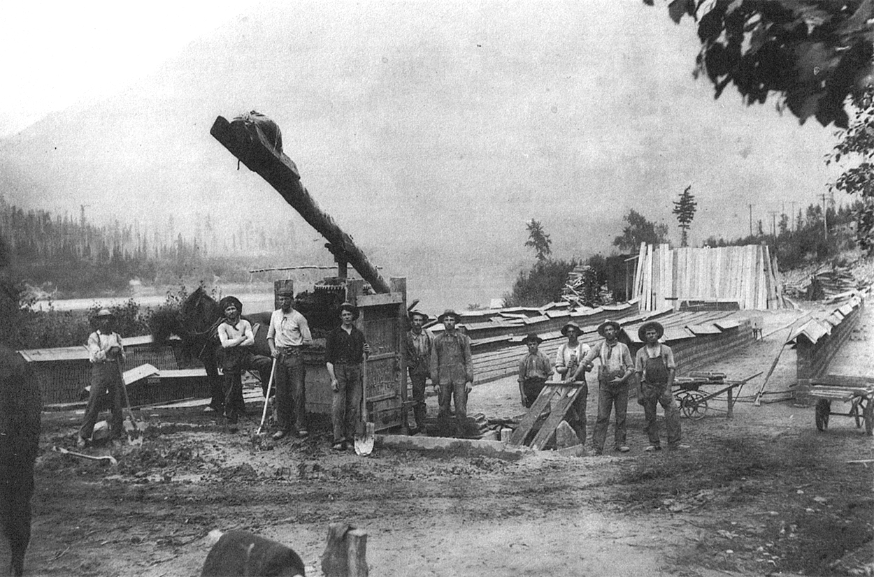
The historic horse-driven Castlegar Brick Works , a fascinating story by Harold Webber. - Trail Cominco photograph.

Fruktova Brick Works with promising clay pit and steam-driven "Martin" machine at left, and drying sheds at right.
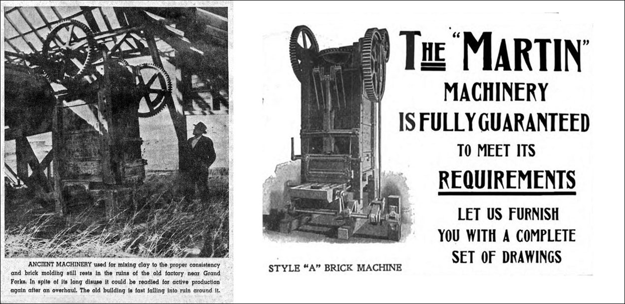
Read Bill Rozinkin's story of the Fruktova Brick Works as it appeared in the Nelson News. (Link)
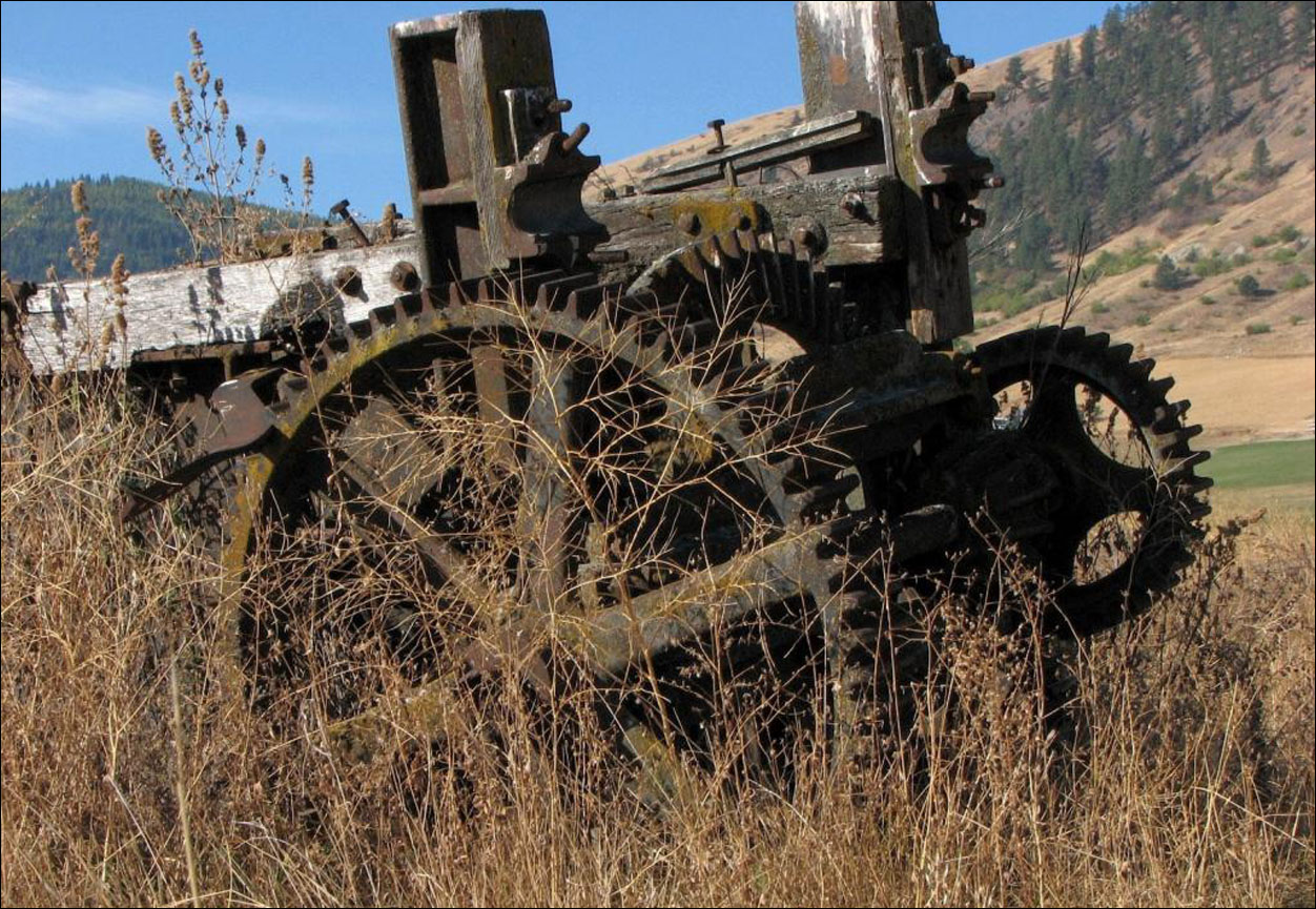
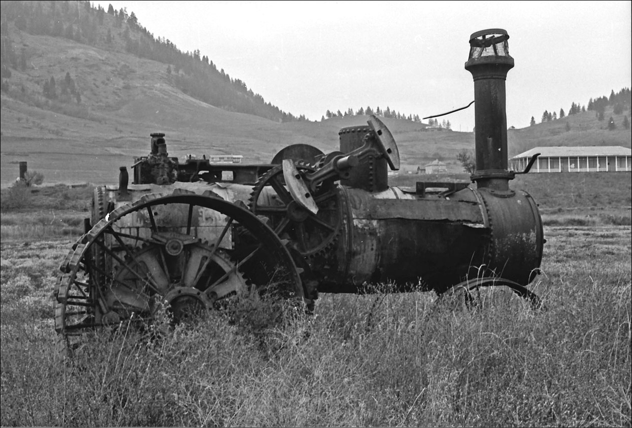
A Gary Trent photograph of a rusty "magnificent derelict" - the Martin brick-making machine near the old brickyard.
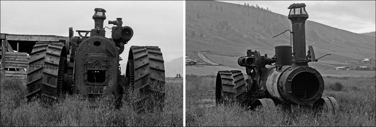
A steam tractor that according to W. Rozinkin, had at one time powered the Fruktova brick-making machine, photographed by the author of this web page, in the mid-nineteen seventies.
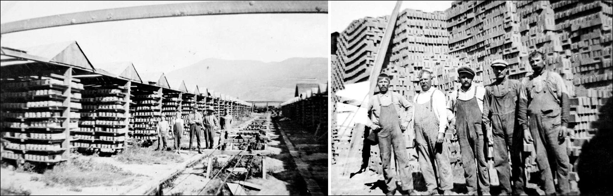
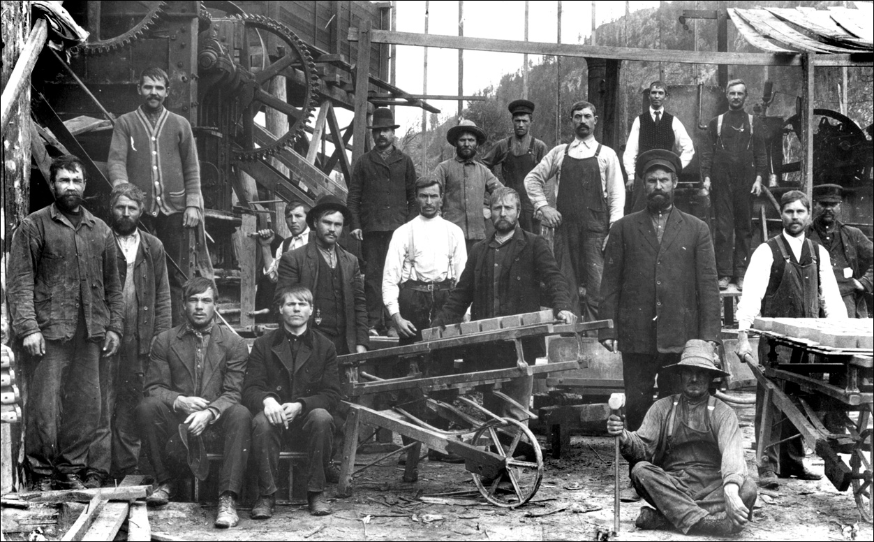
The Fruktova brick factory and its workers. The Martin Machine is also seen below in a remarkably photo of a similar Doukhobor brick plant said to be at Winlaw in the Slocan Valley.
A Blacksmith Shop becomes a Community Hall
The following set of photos depict a Fruktova brick structure that served two very different functions within the community until about 1959.
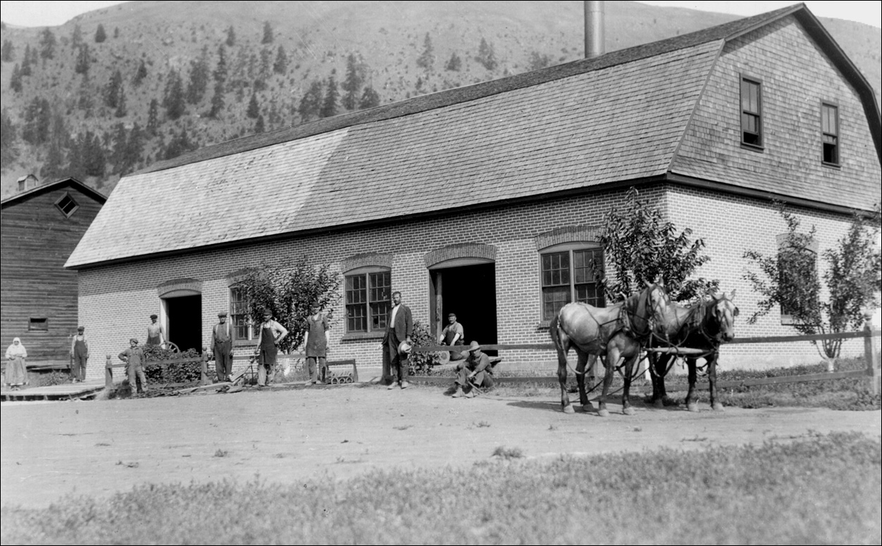
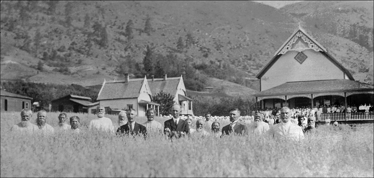
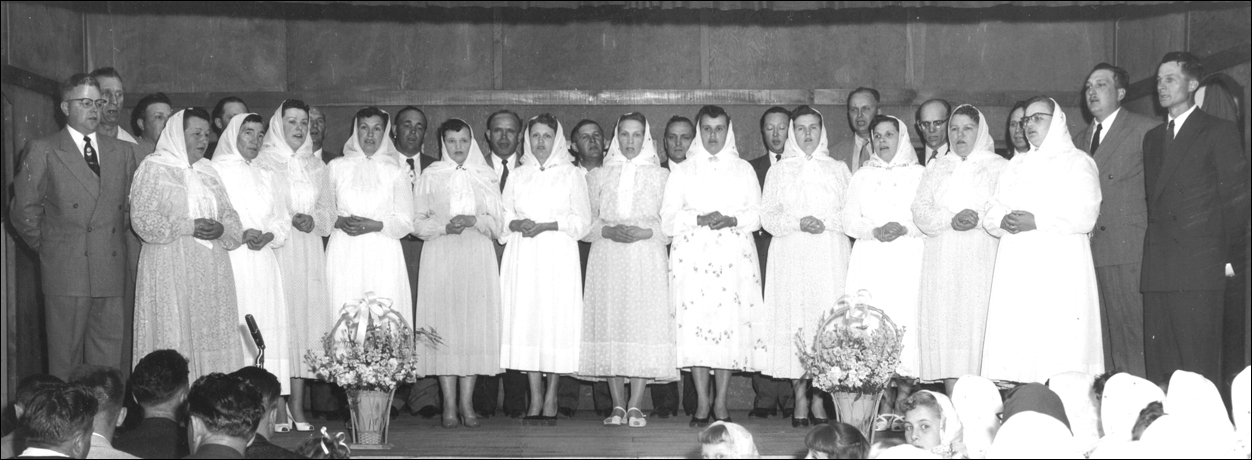
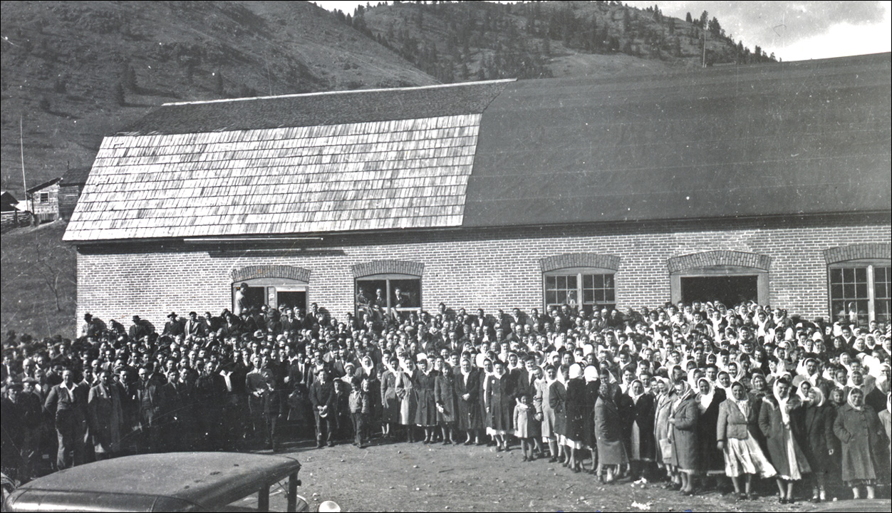
This photograph illustrates the building in use as a blacksmith and machine shop. The building was later adapted for use as a community hall, after its predecessor, a more "elegant" structure at Sirotskoe (depicted below), was destroyed by fire. The shop was retrofitted with a raised performance stage, and ample seating room for prayer services, public events, and even Russian language school classes. It is depicted below in 1948, serving as a venue for the very first annual USCC Doukhobor Youth Festival, an elder choir however, is seen here performing. The Fruktova hall was eventually abandoned after the construction of a modern more commodious community centre on Doukhobor lands closer to Grand Forks in 1959.

Depicting Abandonment and Demolition
These colour photographs of the Fruktova district, commonly referred to as "Sion" since the 1940s, were taken on three different occasions by this author. The upper photo was taken first, in 1970. It depicts the Gritchin village and the blacksmith shop/community hall which had essentially been abandoned by then since the early 1960s, as was the Fruktova school, although that building was to be restored and would function for a time as the Doukhobor Historical Society museum in the early 1990s.
The photo composite below is from a larger set of digitized colour slides taken in the early spring of 1975.
The two photos in the top row of the composite - depict the remaining concrete and stone foundation of the dismantled community blacksmith shop at left, and the remains of the Gritchin village at right with a view of the Fruktova school in the distance.
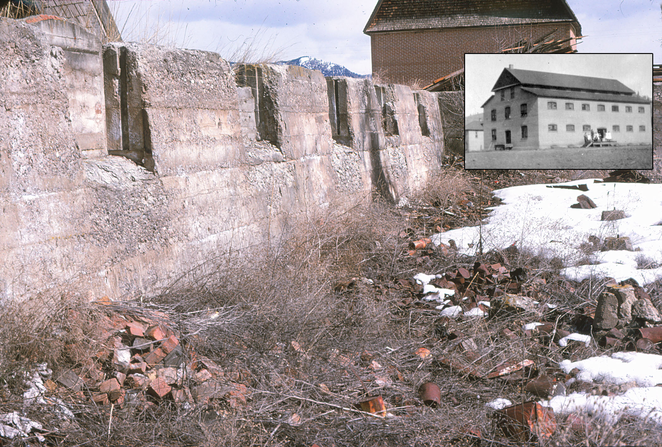
In the middle row - the photo at left depicts stacks of salvaged brick and hand-made wooden desks that were formerly used throughout the Doukhobor community for Russian language school classes. The photo beside it to its right, of a concrete foundation was taken at the same time, and it may be the only remaining photographic evidence of the former Fruktova Jam Factory. A closer look reveals a few remaining abandoned bricks and rusty old tin cans. (enlarge) The concrete foundation was broken apart and subsequently buried or trucked away.
The two bottom photos depict the old Fruktova jam factory steam boiler plant, and the granary.
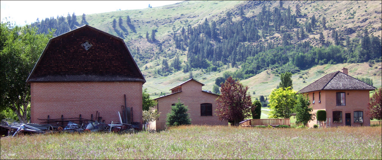
This is a digital photo of the same structures in 2007, the two storey building at right, then occupied as a family residence by the Padmoroffs. A Google Street View of this site reveals that it is proudly and perfectly manicured by the family to this day.
The Fruktova Lower Bench in west Grand Forks
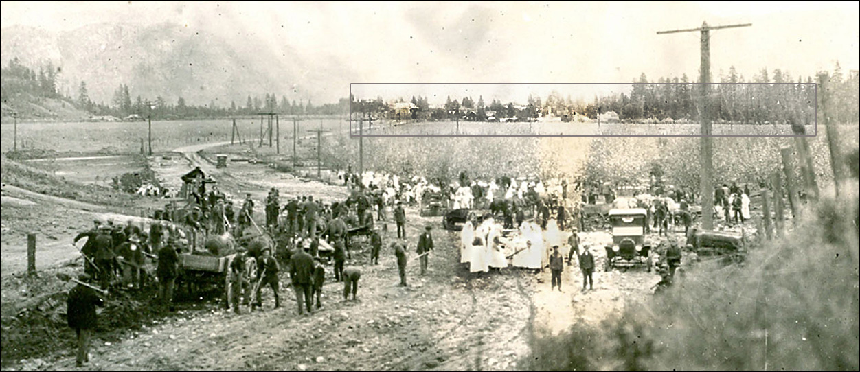
The Saddle Lake flood of 1923 also affected the lower bench of the Coryell ranch (DL 453) at its extreme eastern extent, which was also at that time the eastern limit of the Doukhobor land holdings. A clean-up operation is seen at work here in a clipping of the larger flood photo. (Link) A number of non-Doukhobor ranches or acreages, were likewise flooded, and were purchased by the CCUB afterwards. They are depicted further into the distant background of the photo, where the settlement cluster at the tree line is of particular interest. A bit of Photoshop enhancement reveals faint evidence of the Glaspell, later Astofooroff, house and "gray barn", as well as the A.D. Morrison, later Novokshonoff, farm buildings. A portion of the famed Frache Bros. nursery is also depicted there, although it likely extended even further right toward the Kettle River. Much of this lower Fruktova bench was purchased in 1928 by the CCUB in the Peter P. Verigin "Chistiakov" era, virtually extending Fruktova to the western city boundary limit of Grand Forks itself.
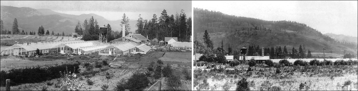
The Pride of the Valley Flour Mill
The following extraordinary colour photograph is from a set of Autochromes restored from glass negatives salvaged by technicians at the Doukhobor Discovery Centre. It is not an artificially colourized image. This settlement is not depicted in the flood photo, but it was situated immediately at bottom right beyond the scope of the flood photo.

A steam-powered stone grist mill operated here until the 1930s, grinding local grains and wheat shipped from the prairies, into whole wheat flour. A granary is seen here for storing bulk wheat, as well as a smaller auxiliary processing facility, said to be used for drying fruit, producing linseed oil and even supposedly canning tomatoes. This site was also known as the Kootnikoff village. Its flour milling legacy is maintained here today in electrified form, as the modern "Pride of the Valley" flour mill, a heritage site and a working mill maintained largely in the summer months by a non-profit society. (Link)
Sawmilling at Fruktova
Not seen here, but of historical significance, was a small sawmill, the first Doukhobor mill in Grand Forks, built just out of view in the flood photo at left. It was put to use milling lumber for the construction of the first Fruktova communal houses. The mill was abandoned and reconstructed in upper Fruktova (Meeres photograph) in the 1920s, while certain remaining buildings from the original mill were later relocated to the Novokshonoff villages nearby. A six inch layer of surface sawdust remained here at York Road under the Coryell bluffs until at least the 1960s. The Doukhobor sawmills were to some extent portable, following their source of timber from community-owned forests and from public timber sales. The Fruktova mill was moved once again by the CCUB to Spencer, and located at the foot of the dirt road to the Ozeroff village, harvesting timber from the July Creek forested acreages below Atwood mountain. An elaborate operation, the mill was ultimately destroyed by arson in the 1930s. A final private mill operated by Kalmakov & Swetlishoff, operated here on this same site in the 1950s employing a half-dozen or so workers, milling dimension lumber for the Grand Forks Sawmill.
A. D. Morrison, a well known local jeweller and optician
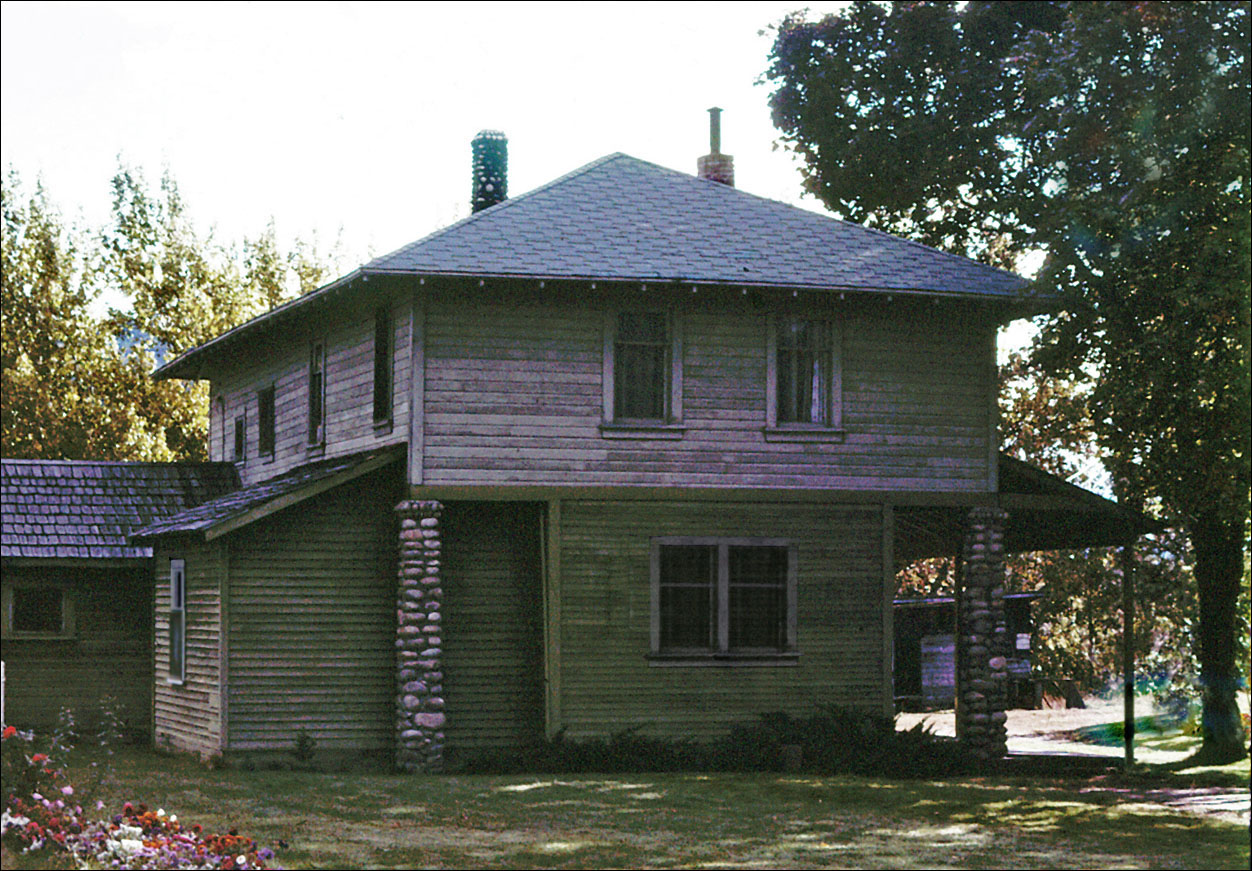
This photo, taken in the 1970s, depicts the former residence of Mr. and Mrs. Morrison, which aside from a recent coating of vinyl siding, has seemingly changed little structurally since the early 1900s and its original condition.
- J. Kalmakov photoThe Grand Forks Evening Sun reported that the Morrisons had previously lived on Church Street within the Van Ness Addition in Grand Forks city, but they bought this 11 acre property west of town in 1907 potentially for agricultural purposes, from George Averill, the original recipient of the Crown Grant (DL. 1699). In the following years, Mr. Morrison moved an existing Averill house closer to the river and with further additions, renovated it into a modern two storey structure equipped with electric lighting and modern plumbing. And the Morrisons moved into the home several years later in 1914. (Link)
While he operated his celebrated downtown jewellery business on Bridge Street, Morrison also erected an enormous horse barn, and additional dairy and poultry buildings on this acreage. But his greatest interest was seemingly his apple orchard, an interest he shared with his immediate neighbour across the highway, school principal, Hugh Glaspell. Morrison installed a modern electrical water pumping station at the river's edge below his property, and also shared his irrigation system with his neighbour via culvert under the public road. Both orchardists became members of the local Fruit Growers Association, and A. D. Morrison also served as a Grand Forks city alderman for the West Ward.
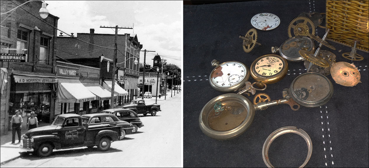
The CCUB Doukhobors purchased this Morrison property in about 1928, and two or three Novokshonoff families from the Spencer Hlookoff village were relocated here, and occupied this house and property well beyond 1938 and the foreclosure of the CCUB, into the 1990s. Mr. Morrison however maintained his downtown business for a time, while the new owners on occasion discovered seemingly discarded remnants of his downtown jewellery enterprise in the attic and under certain hidden stair treads of his spacious old house.
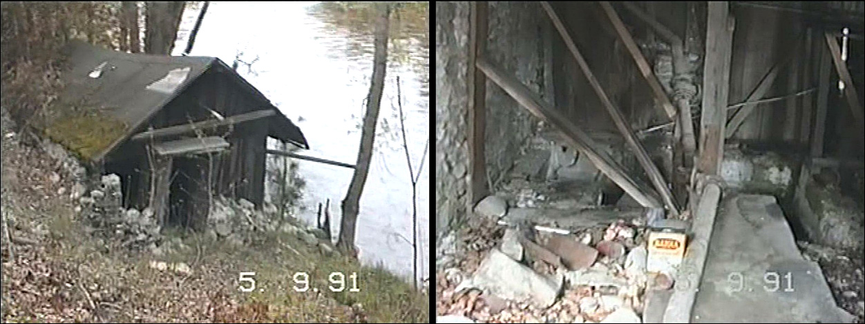
A. D. Morrisons's electrical water pumping station at the Kettle River's edge. - J. Kalmakov old video screen cap.
The Glaspells, Morrison neighbours, and friends of the Doukhobors
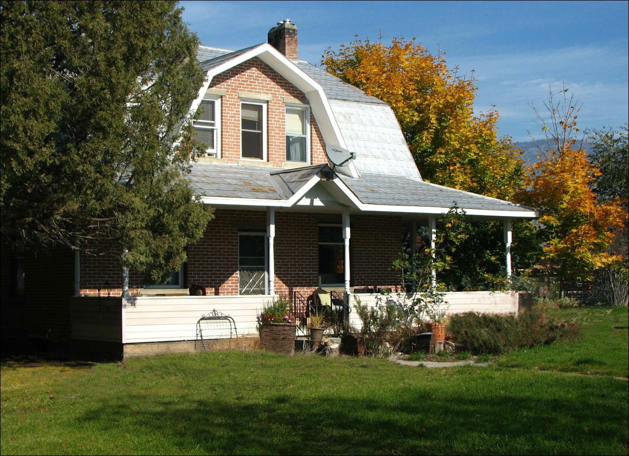
The old Glaspell house, somewhat obscured by trees in this photo, was not overlooked by the curious wandering eye of Grand Forks photographer, Gary Trent. This is one of dozens of exceptional photographs he contributed to the Doukhobor community depicting the machinery and architectural relics of the CCUB era as he found them throughout the Sunshine Valley in all seasons of the year.
This house was built for the Glaspells by Doukhobor carpenters, and was faced with Fruktova-fired brick. It too, like the Morrison house, was likely purchased by the CCUB in 1928, housing the Astofooroff and Sookarookoff families for decades into the 1980s. Oddly enough, the residence is however most often identified by its associated silvery-gray barn, that had been a well known easily recognized local landmark in this neighbourhood.
The Glaspell family story, authored by a descendent, appears in Boundary Historical Society Annual Report No. 12 (Link), and it also offers additional useful insights into the history of the surrounding neighbourhood.

The Astofooroff "Gray Barn" was photographed by this writer from various angles in the mid-1970s to document its architectural features, and potentially preserve the landmark in the form of a watercolour.